I’ve already written several articles about my wanderings through Paklenica. But I’ve never introduced you to the coastal town of Starigrad, which I love very much and use as “my base” when exploring the corners of Southern Velebit.


This town offers everything I need: unspoiled nature in the surrounding area, peace and quiet (especially in spring and fall), the blue sea, warm sunshine, and a touch of history.
*A Brief History*
Although the coastal slope of the Velebit Mountains appears uninhabitable at first glance, the area where Starigrad and the nearby village of Seline are located today has been settled since prehistoric times. This region has been inhabited for at least ten thousand years.


It is believed that small groups of hunters inhabited this area during the last ice age. At that time, the sea level was 120 meters lower than it is today. The entire northern Adriatic was at that time a vast grassy plain where herds of wild cattle grazed. The Velebit Channel was a wide valley through which a river flowed. And the Velebit Mountains were cold and inhospitable, their highest peaks covered by glaciers. When sea levels began to rise at the end of the Ice Age, people had to seek new ways to survive in higher, mountainous areas. It is from this period that the oldest traces of human presence on Velebit originate.


Eight thousand years ago, groups of shepherds and farmers appeared in the Adriatic region. They arrived by sea in small groups, bringing with them wheat, domesticated livestock, and basic knowledge of how to raise them. Thus began the pastoral life on Velebit, which remained one of the most important economic activities until recently. Pastures were scattered across the mountains at various altitudes, offering the possibility of seasonal use.


The Bronze Age brought life in larger communities and the construction of the first buildings. Many strategically important points on rocky promontories were fortified with walls—such fortifications are called hillforts and served a defensive purpose. Today, they have been destroyed. Well-known hillforts were located above present-day Modrič, Selina, Starigrad, and Milovac, which protected a large area of fertile fields in this part of the coast. Around the hillforts were the graves of local rulers from the Bronze and Iron Ages who governed this region. Most of the burial mounds were dug up long ago, and the graves were looted.
During the last two centuries before Christ, the eastern coast of the Adriatic was gradually occupied by Roman troops. At the beginning of the 1st century AD, the Roman province of Dalmatia was established. It was during this time that Starigrad—then known as the Roman town of Argyruntum—was founded, and it quickly developed into an important commercial center. The town prospered during the “Pax Romana.” Life in the town “died out” at the beginning of the 4th century, when the invasions of “barbarian” tribes began.
The Middle Ages were marked by the “Great Migration.” It was during this period that the Croats arrived in Dalmatia. The oldest surviving trace of their presence is the Church of St. George in Rovanjska (built in the 9th–10th centuries). In Starigrad, a similar trace is the Church of St. Peter.
Two centuries of wars with the Turks followed, as a result of which the foothills of Velebit suffered greatly and fell into ruin. In 1527, the Turks occupied Lika and the Dalmatian hinterland, as well as the town of Obrovac on the Zrmanja River. A little later, they also occupied a large part of Ravni Kotari. After they penetrated into the Novigrad Sea, land connections between the northern and southern parts of Croatia were completely severed. As a result, the coastal slope of Velebit (including Starigrad) turned into a “no man’s land” and became the scene of frequent military operations and raids. This situation lasted for approximately 150 years. As Turkish power waned, Venetian authorities began repopulating the abandoned Starigrad as early as 1671. By the end of the 17th century, nearly the entire foothills had been repopulated. In 1700, the Turks withdrew definitively, and the foothills of southern Velebit became part of Venetian Dalmatia.
Later, Dalmatia was briefly ruled by the French (1806–1814), and in 1815 it became part of Austria-Hungary (until 1918).
*My thoughts ☺ *
The center of Starigrad, where most of the cafés, restaurants, and historical landmarks are located, is bounded by the area between Stjepan Radić Square and the side streets of Sv. Jurja and Stjepan Bušljeta. It is a coastal area with a harbor.


If you walk about 700 meters from the square along St. George Street, you will come to an information board describing the Roman town of Argyruntum, which stood on the site of today’s Starigrad.

If you turn your back to the information board, you’ll see an old cemetery with the ruins of a small church. Take a walk through it and try to sense the magical aura emanating from this place.


Then continue along St. George Street along the coast for about 100 meters, and you will come to St. George’s Church. This church was built in 1850, and services are still held there today.

If you continue down the same street to the end (where it turns into Franje Tudman Street), you’ll pass several spots perfect for swimming in the sea, as well as my favorite restaurant, Dalmacija, where you definitely shouldn’t miss their delicious chocolate cake for dessert ☺.


My favorite café-bar, B & T, is located at the intersection of Sv. Jurja Street and Franja Tudmana Street, where I usually stop for a cup of coffee or a draft beer while strolling through Starigrad.


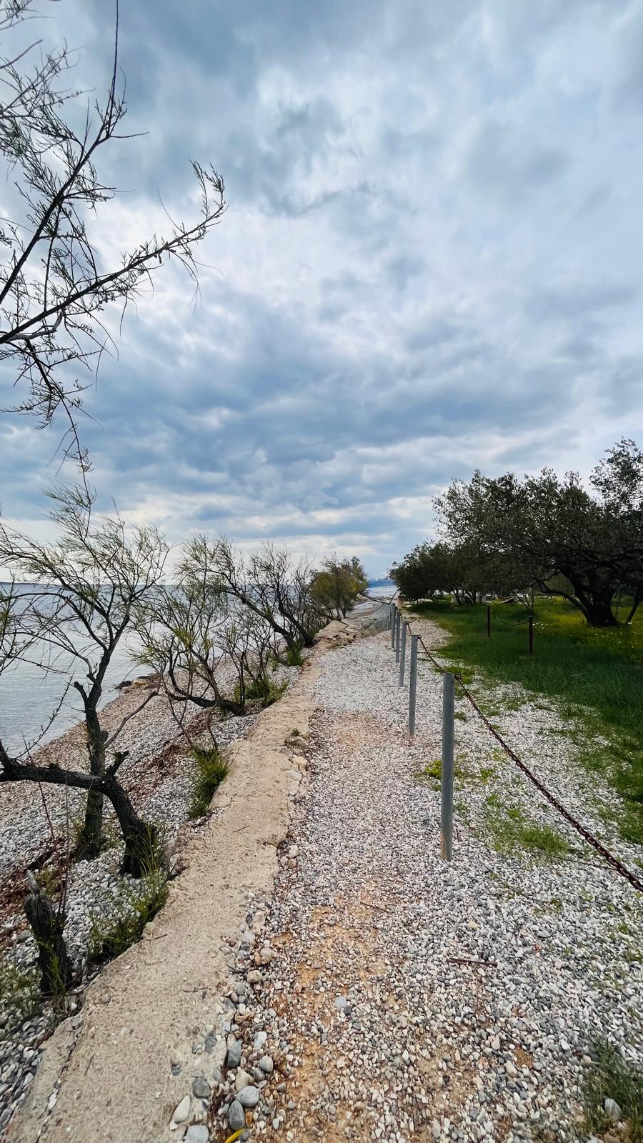
I recommend continuing along Tudmana Street toward the village of Seline, then turning right at the campground entrance and continuing along the coast. You’ll reach the beaches belonging to the Bluesun Hotel Alan resort. Note: You’re only allowed to take this walk outside of the official season! If you want to walk there during the season, continue along Tudmana Street past the campground entrance and turn right only after you’ve passed the hotel complex, right behind the Tommy supermarket, and head straight toward the sea.


You’ll arrive at a beach where I love to swim. I recommend continuing along the coast toward Selina, and from a distance you’ll see the silhouette of the ruins of a tower called Večka kula (meaning “big tower”). This fortification was built by the Venetians in the 16th century to defend against the Turks. During the Turkish attacks, the tower played a crucial strategic role in controlling ship traffic through the Velebit Channel. Archaeologists believe the tower had three stories. Many legends are told about the tower, the most interesting of which is about King Pasoglav (Dog’s Head).


According to legend, King Pasoglav, who had a human body and a dog’s head, once lived in Večka Kula. He was always shaved by a different young man, since the king had anyone who shaved him and saw his true form executed, so that his secret would not be revealed. The mother of one of the young men who was to shave the king devised a way to save her son. She mixed bread with her own milk and gave it to her son to offer to the king. After the shave, the king ate the bread, and then the young man told him that the bread also contained his mother’s milk. Since they had become brothers thanks to the young man’s mother’s milk, the king decided to let him go, but ordered him not to reveal the secret of the dog’s head to anyone.
The young man kept the secret to himself for a long time, but eventually decided to entrust it to the earth. He dug a hole, bent down, and whispered the secret. Later, a elderberry bush grew from the ground, from which a certain shepherd made a whistle. When he began to play it, the words rang out: “Our king has a dog’s head.” The secret spread, and King Pasoglav remained unshaven and in solitude until his death, while the young men no longer had to fear death in the royal fortress.


The site of the Večka Kula ruins is actually the Kulana Beach headland, so feel free to take a dip ☺.


If you’re not into hiking but love beautiful views, I’ll give you two tips—and you can easily get there by car.
Alojz Stepinac Street leads from Starigrad into the mountains. This road connects the town with mountain villages such as Dokoze, Katalinići, and Milovci. The entire stretch is 6.5 km long and ends at a parking lot in a mountain pass between the peaks of Gradić and Kojića glavica. The entire route is uphill, and you pass by interesting rock formations along the way. And the views, whether toward the sea or toward Velebit, are truly impressive. You’ll need to drive more slowly due to the narrow paved road and cyclists, but otherwise the entire stretch is easy to navigate.


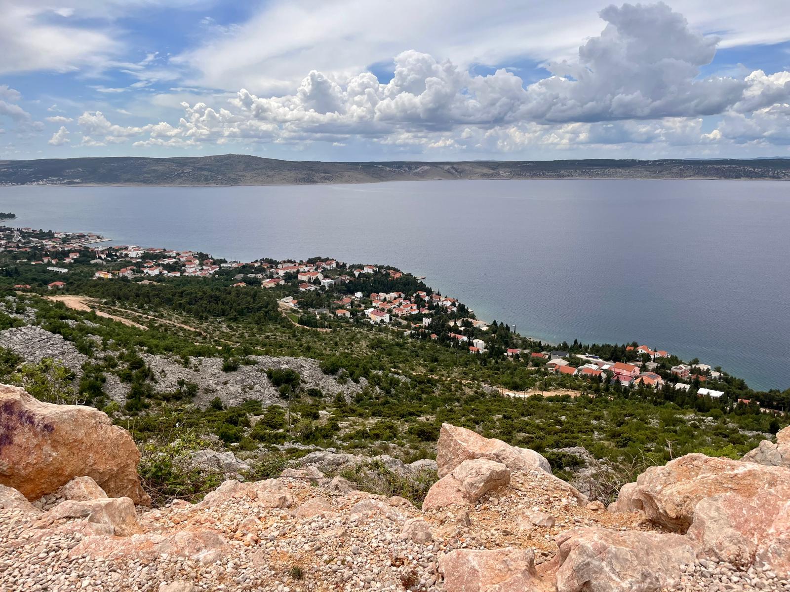


The second option is to drive to the village of Modrić (about 10 km) along the D8 road and then turn off into the mountains onto Road 907. The road gradually climbs, taking you past the hills of Gromila (141 m), Visoka Glavica (253 m), and Kitnasta Glavica (286 m). If you’re lucky ☺ and come across cows or other farm animals (which graze freely here) on the road, you’ll definitely have to slow down, since the local cows have their own rules ☺.


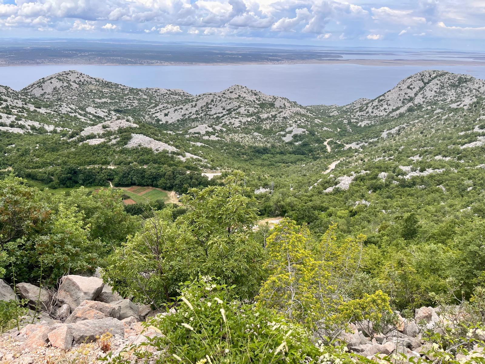
After about 5 kilometers, the paved road ends and a dusty, rocky path begins. If you’re driving a lower-clearance vehicle, you should slow down just to be safe, but it’s easy to navigate (I drove a Skoda SUPERB). Gradually, you’ll climb above the Visoka glavica peak (509 m), pass between the Veliki kuk (777 m) and Debeli kuk (728 m) peaks, and arrive at a beautiful spot at an elevation of 900 m called Libinjska kosa.


From here, you can begin your ascent to the main ridge of Southern Velebit—the nearest peak is Sveto Brdo (1,750 m). It feels like a different world here, especially if you’re coming from the sea, because as you cross the Libinjska Kosa, you’re moving from the coastal world into the heart of Velebit. You can return via the same route, or there’s another option—drive further along Route 1003 across the plateau for about 7.5 km, and after the Alanac peak, you’ll connect to the famous Majstorska Road. Here, you really need to drive slowly to avoid hitting the undercarriage or getting a flat tire. But this little adrenaline rush is really worth it ☺. You can then decide whether to turn left on Majstorska Road and continue all the way to the village of Sveti Rok, or turn right and, after one and a half kilometers over the Baćin Stolac Pass (912 m), reach the Vrhprag Pass (856 m). This pass is known as the starting point for the ascent to Tulove grede. It’s also famous for the “Winetou” films, as many scenes from these movies were filmed here. Then simply descend along Majstorska Road, where you’ll join Highway D547 and return to Starigrad.


Starigrad really has a lot to offer. I’ve shown you a few interesting places, but by no means all of them. I hope I’ve inspired you in some way.


If you decide to follow in my footsteps and need advice on accommodations, food, hiking trails, or other ways to spend your time around Starigrad and Paklenica, feel free to contact me via email at ajka@uzisibalkaninak.com, my Facebook page “Enjoy the Balkans differently” or Instagram.
P.S.: All photos are protected by copyright 🙂